Road Trip to Lake Louise, Alberta
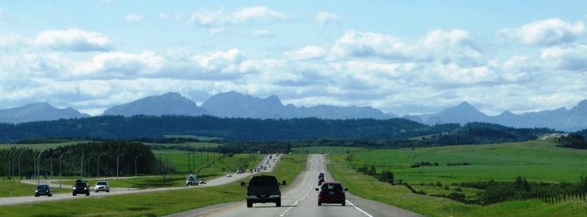
This itinerary shows the highlights along the route from Banff, Alberta to -and around- Lake Louise Alberta.
As a tour guide, I’ve visited this beautiful part of the Rocky Mountains many times. I also enjoyed some time on my own around the ‘jewel of the Rockies’. Let me help you here..
From my experiences, I offer suggestions for
- must sees – Description of highlights in and around Lake Louise
- active adventures around Lake Louise
i) hiking
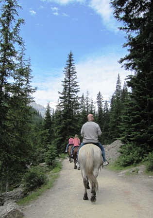
ii) horseback riding
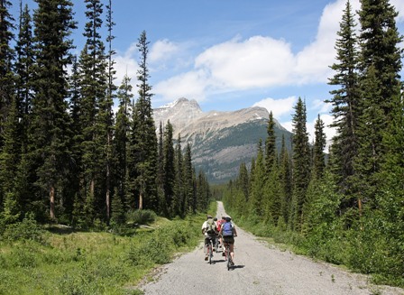
iii) pedal biking
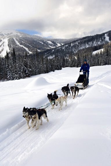
iv) dog sledding
Additional information on this page:
Road Trip Map of the highlights: Bow Valley Parkway (Banff to Lake Louise) and Lake Louise
Itinerary samples around Lake Louise
Services along the route from Banff to Lake Louise
Getting around the Lake Louise and Moraine Lake area
Lake Louise is part of the Roadbook Calgary to Vancouver and Vancouver to Calgary
Road Trip Map from Banff to Lake Louise, Alberta
Services along the route from Banff to Lake Louise Alberta
Gas Stations
Banff & Lake Louise mall
Shopping / groceries
Banff & Lake Louise village /mall
Restaurants
Banff, along the Bow Valley Parkway (Hwy 1a), Lake Louise
Accommodation
Banff, along the Bow Valley Parkway (Hwy 1a), Lake Louise
Campgrounds
Banff, along the Bow Valley Parkway (Hwy 1a), Lake Louise
Cell phone reach
Unreliable along this route
Description of highlights from Banff to Lake Louise Alberta
Bow Valley Parkway
After your visit to Banff and surrounding area, take Highway 1 West. Take exit 1a - Bow Valley Parkway-, 5 minutes later. You need a valid park pass for driving the Bow Valley Parkway.
This route is an alternative for, and runs parallel with, Hwy 1 from Banff to Lake Louise, Alberta. The speed limit on this road is 60 km/35 mi. per hour. The easy pace increases your chances of seeing wildlife. In contrast to Hwy 1, it’s allowed to pull over to the side of the road as long as you don’t impede other road users. Always keep a safe distance and stay in your vehicle when spotting wildlife. Never feed wildlife!
Review bear watching etiquette.
If you're eager to spot some wildlife, drive the Bow valley Parkway (Hwy 1a) early morning. When lucky you might spot some elk, bear, osprey, bighorn sheep or even wolf. Check for travel restrictions.
Johnstone Canyon
Johnstone Canyon is located 17,5 km/10,9 mi. after entering the Bow Valley Parkway.
A very scenic and easy trail leads to the Lower and Upper Falls of Johnstone Canyon. This is a popular trail. Therefore, the earlier you start, the smaller the crowds.
Follow the trail on the west side of the creek to reach the Lower and Upper Falls. Stay on the trail and keep children close to you (don’t go past the fences; the rocks are slippery and accidents have claimed a number of lives over the years)
Johnstone Canyon characteristics
Lower Falls
one-way 1,2 km/0,7 mi.
+ 30 m/98 ft elevation gain
1 hour round trip
Upper Falls
one-way 2,4 km/1,5 mi.
+ 120 m/394 ft elevation gain
2 hours round trip
If
you’re into a moderate hike, continue another 3 km/1,9 mi. past the
Upper Falls
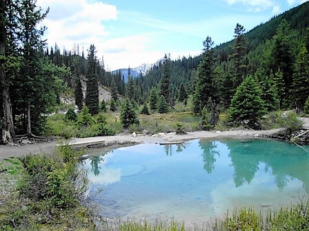
till you reach the colourful mineral springs, called the Ink
Pots.
Ink Pots
one-way 5,4 km/3,4 mi.
+ 215m/705 ft elevation gain
4 hours round-trip
All distances are measured from the parking lot east of Johnstone Creek.
Osprey nest
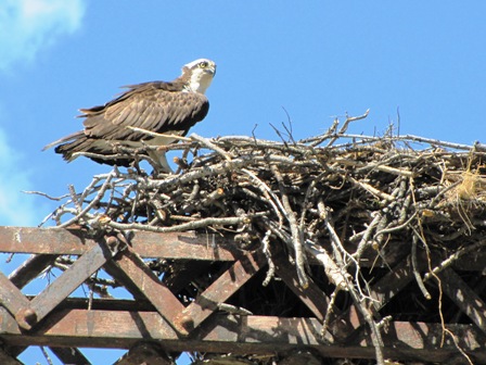
Continue the Bow Valley Parkway another 6 km/3,7 mi. and turn left towards Hwy 1. On top of the bridge that crosses the Bow River, you’ll see a large heap of sticks and driftwood. It’s an osprey (fish eagle) nest.
As ospreys mate for life, every summer a couple of these raptors return from South America to this location. During the Canadian summer, they raise their chicks on top of the bridge. It is the perfect location as the river provides adequate food supply.
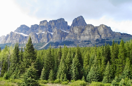
Turn around and continue your route along the Bow Valley Parkway. Impressive Castle Mountain is right in front of you.
Castle Mountain lookout
Continue the Bow Valley Parkway towards Lake Louise for 1 km/0,6 mi. to Castle Mountain lookout.
No need to say why this mountain, with 2 levels of steep cliffs, has got its name.
Continue route
Continue on the Bow Valley Parkway another 28 km/17 mi. to Lake Louise village (Samson Mall).
Lake Louise village (Samson Mall)
Here you’ll find several services such as a gas station, post-office, Parks Canada visitor centre, a grocery store, restaurants, a café, bakery, and a mountain sport store with bike rentals.
Getting around the Lake Louise and Moraine Lake area
The Lake Louise and Moraine Lake area are very popular destinations. Parking is limited, especially at Moraine Lake. Lake Louise offers paid parking from mid-May till mid-October. Both fill up early morning and stay filled for the rest of the day.
Booking a seat on a Parks Canada shuttle is the best way to reach both Lake Louise as Moraine Lake.
You can book your seat using the Parks Canada reservation system 48 hrs before departure. Read more on how to get around the Lake Louise area.
Moraine Lake
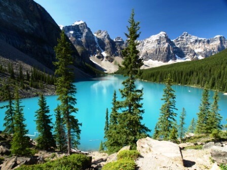
From the mall, continue onto Lake Louise Drive for about 2 km/1,2 mi. Turn left onto Moraine Lake Road and follow the road for 12 km/7,5 mi. The lake is located at an elevation of 1885 m/6185 ft.
The view is SUPERB! Nested within the Valley of the Ten Peaks, you have to see this intense turquoise coloured lake from the top of the rock pile.
Realize you will not be the only visitor. During high season, it is better to visit Moraine Lake before 11 am or after 3.30 pm. My suggestion is to go here early morning (best for parking space as well as for picture exposure), and hike to Sentinel Pass and back. Read more
Check for details with Parks Canada
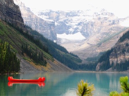
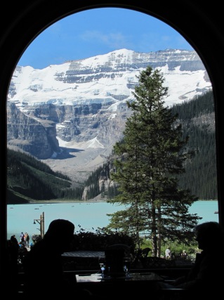
Lake Louise
Another very popular stop for visitors is Lake Louise. If you have some spare money to spend, consider staying in the Chateau :-)
Lake Louise history
In 1882 outfitter Tom Wilson was exploring the area. He camped at the confluence of the Bow- and Pipestone River. When he heard some rumbling, he asked his native ‘Stoney’ guide, where the sound originated. His guide told him it was caused by ‘the avalanche of the snowy mountain above the lake of little fish’.
When Wilson visits the lake the next day he names it ‘Emerald Lake’ due to its colour.
In 1884 the lake is renamed to honour Princess Louise Caroline Alberta, the fourth daughter of Queen Victoria. Princess Louise was married with Sir John Campbell, then Governor General of Canada.
Lake Louise facts
Length: 2,4 km/1,5 mi.
Depth: 90 m/295 ft.
Elevation: 1536 m.
Average temperature of the water: 9 ˚C/48 ˚F.
From November until June, the lake is frozen -no wonder the fish in here are small.
Chateau Lake Louise
In 1890 the Canadian Pacific Railway –CPR- builds a log cabin to host visiting mountaineers.
After a fire destroyed the cabin in 1893, it’s rebuilt and extended to host up to 400 guests.
Another fire struck again in 1924, burning down the wooden Rattenburry (architect) wing. A concrete wing replaces the burnt one in 1925.
In 1986 several renovations were carried out.
Nowadays the 'Chateau' can host 1100 guests in 515 rooms.
It’s worth to take a look inside the Chateau by strolling down the public hallway.
Plain of Six Glaciers Tea House
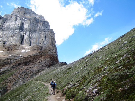
Follow the lake shore trail past the end of the lake. After 5,3 km/3.3 mi. you reach the Swiss built tea house (1924). The first 2 km are wheelchair accessible without any elevation gain.
At the end of the lake, the trail gets narrow and rocky. Over the next 3 km/1,9 mi. you will gain 365 m/1198 ft. elevation.
Distance one-way: 5,3 km/3,3 mi.
Elevation gain: 365 m/1198 ft
Duration: 4 hours return
Itinerary samples
Day Itinerary Sample of the Highlights
Stick to the ‘must sees’ from 1st map layer. One day in the area will cover the highlights of this module.
Timing
8.00 am Leave Banff
8.30 - 10.30 am Johnstone Canyon hike to Upper Falls *
10.30 - 11.30 am Bow Valley Parkway, stops included
12.00 - 1.00 pm Lake Louise village - lunch
1.15 - 2.30 pm Lake Louise, stroll along the lake shore
3.00 - 4.00 pm Moraine Lake
5.15 pm back in Banff (via Hwy 1)
* When you’re not into being active at all, skip Johnstone Canyon. This will give you 2 hours extra to play with.
Day Itinerary Sample: Get Adventurous
If you’re into being active, spend a minimum of 2-3 days in the area.
Timing active day 1
8.00 am Leave Banff
8.05 - 9.30 am Bow Valley Parkway (hike isn’t included in timing, suggested stops are incl.)
10.00 - 12.00 am Hike: Plain of Six Glaciers Tea House
12.00 - 1.00 pm Lunch at the Tea House
1.00 - 2.00 pm close view of Victoria Glacier (1.5 km past the Tea House)
2.00 - 4.00 pm Lake Agnes via Highline Trail
5.00 pm back at Chateau Lake Louise
Day 2 suggestion
A must do: visit Moraine Lake and hike either Sentinel Pass or Paradise Valley.
Day 3 suggestion
Bike ride ‘the Great Divide’ and visit Yoho National Park.
Are you more into an adventure vacation in Canada?
Select the Get Adventurous layer in the map.
Choose to go hiking, biking, horseback riding, or dog sledding.
The suggestions I offer are based upon my own experiences as a tour guide in Canada. The possibilities are not limited to the ones you find below, though. However, in my opinion these suggestions are the best and most realistic activities to do around Lake Louise and surrounding area during your travel in Canada.
Hiking
Along the Bow Valley Parkway: Johnstone Canyon Ink Pots
As described above, a very popular, easy trail leads to the Lower and Upper Falls of Johnstone Canyon. Continue your hike through Johnstone Canyon until you reach the colourful mineral springs, called the Ink Pots.
Distance from parking lot: 5,8 km/3,6 mi. one-way.
Elevation gain: 215 m/700 ft.
Duration: 4 hours round-trip
This hike is classified as moderate.
Hikes around Moraine Lake
Hike to Paradise Valley/Larch Valley/ Consolation Lakes / Sentinell Pass /Wenkchemna Pass or Eiffel Lake. Check for details
My favourite hikes around Lake Louise
By hiking one of the various trails you will leave the crowds behind.
Below you find my favourite hikes around Lake Louise, Alberta.
Lake Agnes Tea House
The seasonal trail to Lake Agnes is well
maintained and offers you vistas of Lake Louise and Mirror Lake.
However, the real treat here is Lake Agnes itself. An intimate glacial
lake surrounded by towering peaks. Enjoy a well deserved treat at the
rustic tea house (1901, rebuilt 1981).
Distance: 3,4 km/2,1 mi. one-way
Elevation gain: 385 m./1263 ft.
Duration: 3 hrs return
A short side trip to the Big Beehive offers beautiful vistas of the jewel of the Rockies; Lake Louise.
Plain of Six Glaciers Tea House
Follow
the lake-shore trail past the end of the lake. After 5,3 km/3,3 mi. you
reach the Swiss built tea house (1924). The first 2 km are wheelchair
accessible without any elevation gain.
At the end of the lake, the trail gets narrow and rocky. Over the next 3 km/1,9 mi. you will gain 365 m/1198 ft. elevation.
Distance one-way: 5,3 km/3,3 mi.
Elevation gain: 365 m/1198 ft
Duration: 4 hours return
Past the Plain of Six Glaciers Tea House
If
you still have some energy left, continue another 1,5 km (and 50 m.
elevation gain) past the tea house for a close view of the Victoria
Glacier and for a glimpse of Abbot hut. It sure looks a bulldozer did
some work here. Keep your eyes open for mountain goat on the rocky
ridges above the trail.
Find more info at Trailpeak.com
Highline Trail
Connect Lake Agnes and the Plain of Six Glaciers via the Highline trail.
Distance round-trip: 14,5 km/9 mi.
Duration: 5-6 hours for the whole loop
Horseback Riding
Not into hiking the 5.5 km one-way trail to the Plain of Six Glaciers Tea House? Try the 4-hour horseback ride! This is a great alternative if hiking is not for you. This ride offers you one of the best vistas of all tours that are offered around Lake Louise (another very scenic ride is the one to Paradise Valley – the name says it all).
Pedal Biking around Lake Louise
Great Divide Trail - easy, 10,5 km/6,5 mi.
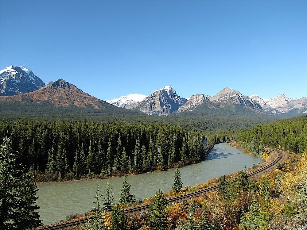
Rent a bike and discover the easy Great Divide Trail, leading to the continental divide. Water floats east via the Bow River towards the Atlantic Ocean, and west via the Kicking Horse River and Columbia River into the Pacific Ocean.
The last section of the road runs parallel with the train tracks. This offers you an opportunity for taking pictures of passing trains with mountains in the background. The accompanying picture has been taken along the Great Divide Trail.
Return the same way for an easy ride, or return via Ross Lake for a more challenging bike ride.
Loping with Ross Lake Trail
About 500 m west of the continental divide, a challenging 1.3 km/0,8 mi.
trail along Ross Creek connects to the Ross Lake Trail. This allows a
loop, returning via Ross Lake. The trail past Ross Lake goes up and
down, along sub-alpine forest, and is for advanced mountain bikers only.
The total loop will be 19,1 km/11,9 mi.
Check the brochures offered by Parks Canada for other hiking and biking trail options.
Dog Sledding
The sound of panting dogs, the view of a damping dog team, the crisp air and smell of winter, the sense of your cold cheeks in contrast to your warm body, and the mental connection with your dog team...
Several outfitters offer dog sledding experiences during wintertime.
Read more about dog sledding vacations.
How to Use the Road Trip Map
Use the map within this website or access each map in a separate full screen window (recommended).
Layers
The map contains 2 layers.
- The first layer covers the must-sees in the region.
- The second layer points out the best activities when you’re more up to an adventure vacation in Canada.
Check or uncheck the box of each layer to hide or show the specific highlights that fit your style.
Icons
The icons in the map tell you the type of sight or activity– viewpoint /hiking/ biking/tea house or other.
Zoom
Zoom in to enlarge a region. The zoom in/out icon is located in the right bottom.
Hold and drag
Hold and drag to move around on the map.
Site info
Click on a specific site to read a description of the site.
Directions
Find directions from any location to a specific site, by clicking the arrow at the bottom of the description box.
